About the Barwon South West region - Otway Ranges
The Barwon South West region - Otway Ranges stretches from the Bellarine Peninsula to Port Campbell and extends inland to Skipton and Winchelsea. It includes areas of rainforest, temperate forest, woodlands and heathlands.
How Victoria manages bushfire risk
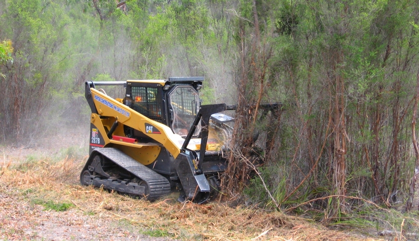
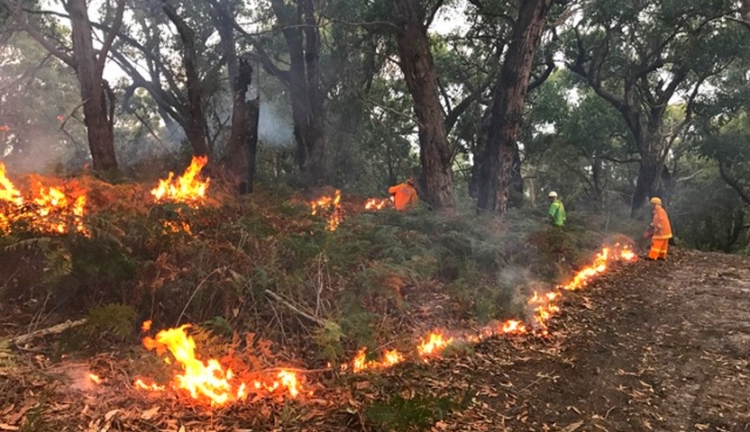
In Victoria, we conduct fuel management activities like planned burning, mulching and slashing to reduce the risk of bushfires causing harm to things we care about. We also conduct planned burning to support plants and animals that need fire for their survival.
On this page
Ultimately, we manage bushfire risk to protect the things we care about.
Our bushfire management planning across the state seeks to protect human life, private property, our economy, critical infrastructure, cultural heritage and the environment.
Here in the Barwon South West region - Otway Ranges, we have worked with local communities and consulted scientific data and experts to understand where the most important values and assets are in our region and how to protect them from bushfire.
Here's some examples of the different values and assets we considered in our fuel management planning.
Human life
Communities said human life is the most important thing to protect from bushfire.
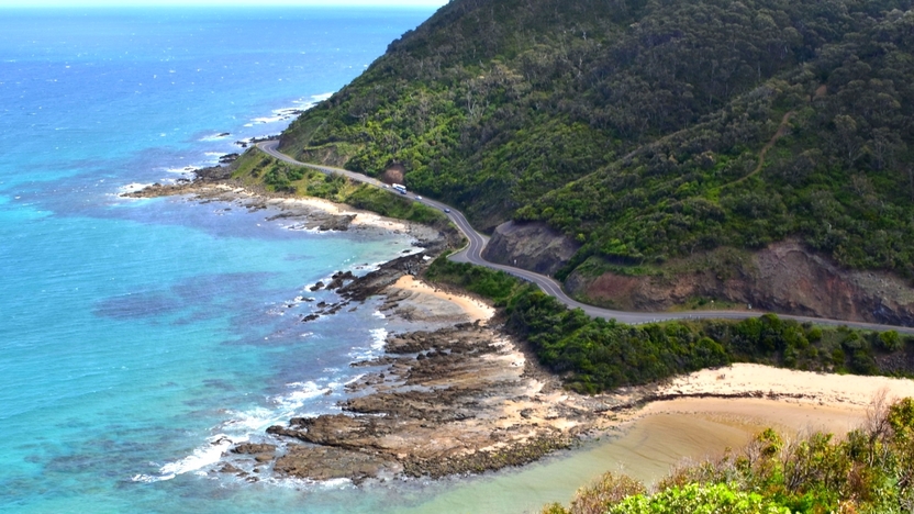
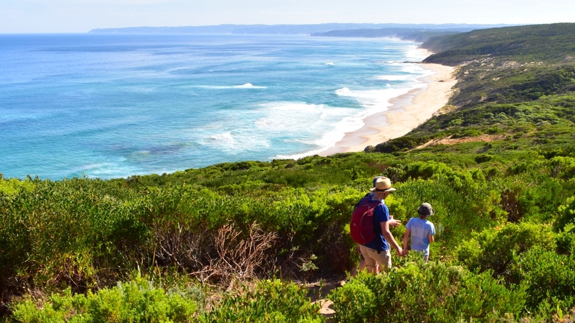
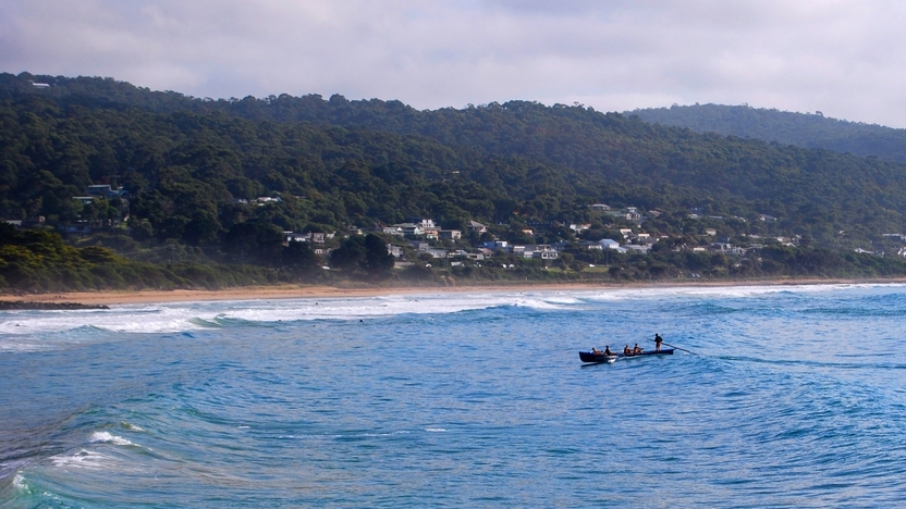
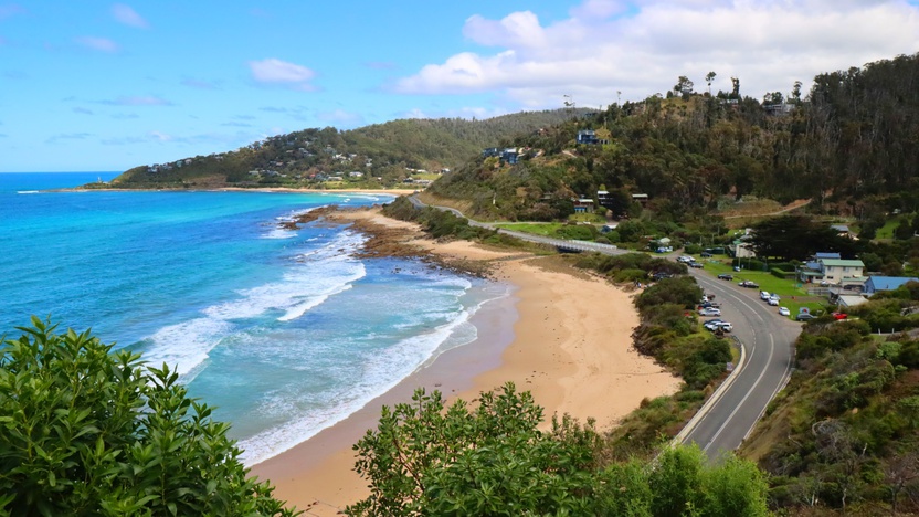
The Otway Ranges has many small towns near forested areas, including Anglesea, Forrest, and Lavers Hill.
The Great Ocean Road also attracts millions of visitors yearly. This greatly adds to the numbers of people staying in, or passing through these towns.
Protecting coastal communities that are surrounded by dense forest is critical to protecting human life in the Otways.
Natural environment
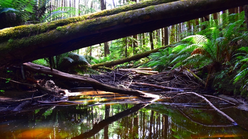
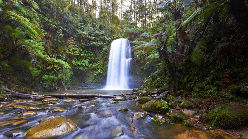
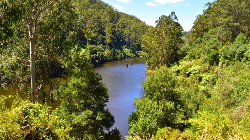
Protecting the natural environment is important to communities who live in and visit the Otways. Public land provides important habitat for many species, and ensures it is cared for for generations to come. The Otways includes National Parks and Forest Parks which preserve areas of rainforest, temperate forest, woodlands and heathlands. Habitat also exists on private land.
The Otways are home to a variety of animals. Some are rare or threatened; such as the Swamp Antechinus
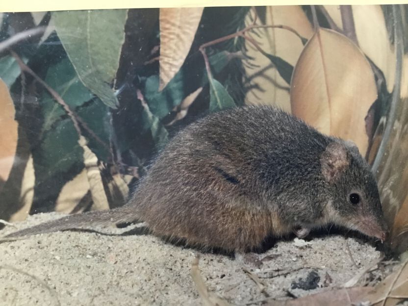
and the Southern Brown Bandicoot. The Otways are also well-known for having a wide variety of plants. There are more than 100 different kinds of orchid in the area.
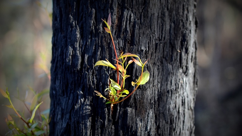
Native plants and animals need different amounts of fire to stay healthy.
Our strategy carefully balances how much and how often we conduct fuel management activities. This helps achieve the best outcomes for different plants and animals.

Regional economy
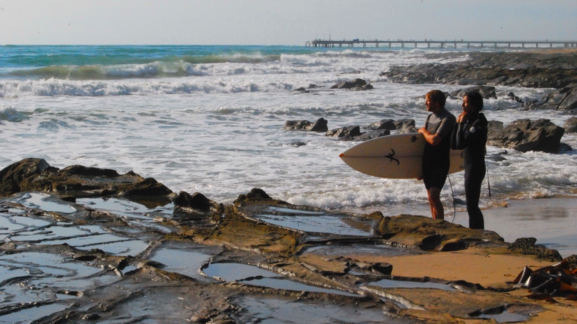
Tourism is a major industry in this area, contributing to both regional and state economies.
There are also many workers in agriculture, and in food and fibre production. Maintaining a healthy, and attractive natural environment supports tourism.
Reducing the risk of losses to agricultural production and wine growing supports local jobs and businesses.
Targeting our fuel management actions to support economic outcomes helps to sustain regional communities.
Critical infrastructure
Critical infrastructure in the Barwon South West includes: Power generation and supply assets, gas distribution networks
It also includes major roads, community facilities and telecommunications towers. Critical infrastructure helps communities access essential services.
Communities said critical infrastructure assets were important to protect from bushfire. Targeting our fuel management actions to reduce risk to critical infrastructure assets supports regional communities.
Private property
Protecting private property from bushfire was also very important to communities.
Private property includes homes, agricultural assets and local business assets, such as shops and offices.
Protecting private property helps reduce household losses, which minimises displacement and disruption to communities. This supports people to stay linked to their neighbourhood and helps communities keep running normally.
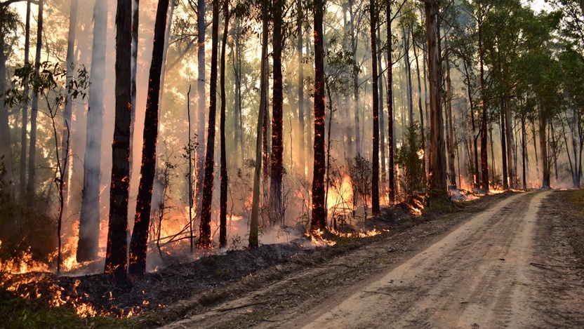
Our bushfire history
This section contains information regarding past bushfires which some readers may find upsetting. Click to skip ahead to bushfire risk in our region or our fuel management strategy.
In the Otway Ranges, our most damaging bushfires start in grasslands north of the ranges and then spread into the forest, moving south-easterly ahead of north-westerly winds.
As strong south-westerly winds set in behind cold fronts late in the day, bushfires can become large and spread rapidly towards coastal townships.
These fire behaviour patterns help us understand which communities might be at risk if a fire started. They also show where fuel management programs are most useful in protecting townships or reducing the spread of fire.
Ash Wednesday
On 16 February 1983, fire in the Otway Ranges claimed three lives, destroyed over 750 buildings, and burnt 40,000 hectares around Anglesea and Lorne.
There were four major fires in the region on what became known as ‘Ash Wednesday’, with human lives also lost in the Branxholme and the Cudgee/Ballangeich fires.
The size and spread of fires were influenced by a wind change from the south west that occurred late in the day.
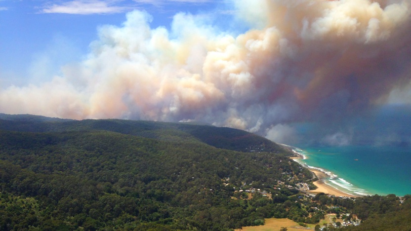
Wye River
The Wye River fire ignited on the 19th December 2015 due to lightning strike. The fire burned for six days, impacting Wye River and Separation Creek on Christmas Day 2015. The fire destroyed 116 homes and burnt more than 2,000 hectares of forest. This map shows the extent of the fire as it was on Christmas morning.
The fire was driven by a north-westerly wind. Rainfall after the fires caused landslips along the Great Ocean Road, restricting access for many months - disrupting communities and tourism.
Bushfire risk in our region
This map shows the risk of house loss in Otway Ranges, which is part the Barwon South West region. The map compares where houses could be destroyed by bushfire across the whole region.
Different shades represent different levels of risk. As the shade progresses from yellow through red to purple, more and more houses are potentially destroyed.
The purple areas have the highest risk of house loss. More houses could potentially be destroyed by bushfire in these areas than in any other areas in this region.
Computer simulations are used to help us estimate houses lost from bushfires. The simulations measure how damaging bushfires could be in different locations. They assume that the fuels in the landscape have increased to the highest level.
This helps us plan where, how often and how much fuel management we do to reduce risks to communities over years, or even decades.
This map does not reflect any recent bushfires or activities that could change the risk in the region. Importantly, this map shows where there is potential for a bushfire to destroy more houses compared to other parts of the region. It does not show risk to individual houses.
Higher risk area: Lorne
We consider Lorne a high bushfire risk township. There is a lot of forest to the north and west of the town. This can mean fires become very large and hot. Fire history and prediction modelling tells us many fires can reach Lorne and cause many house losses.
Lower risk area: Birregurra
In contrast, Birregurra is surrounded mostly by grass, not forest. While grass fuels burn quickly, house loss from grass fires is less likely than for forest fires. Grass fires are not as hot and cause less embers. Fire history and prediction modelling tells us Birregurra would experience less house losses.
Our fuel management strategy
By understanding what communities care about, where bushfires have happened before and analysing what areas in the Barwon South West region - Otway Ranges are most at risk, we can create a strategy. This strategy tells agencies where, how much and how often to conduct fuel management activities to reduce bushfire risk.
We classify patches of public land as different Fire Management Zones – Asset Protection Zones,
Bushfire Moderation Zones,
Landscape Management Zones
and Planned Burning Exclusion Zones.
In each of these zones we manage fuels differently in terms of the frequency and intensity of fuel management activities like planned burning.
Where we conduct fuel management each year is determined by a range of factors, including fuel loads and weather conditions, such as rainfall.
'Fuel' is any grass, leaf litter, twigs, bark and other live vegetation which can burn. Fuel builds up at different rates in different areas depending on how fast the vegetation grows compared to how fast it decomposes.
The way we conduct fuel management in the different types of Fire Management Zones on public land helps us to reduce the intensity, severity and spread of bushfires across the landscape. This contributes to reducing the risk of bushfires impacting things we care about.
We monitor the success of our fuel management program and publish the results in our yearly Fuel Management Report.
Coastal communities
To protect human life and private property from the impacts of bushfire, we target our actions around towns like Lorne and Aireys Inlet.
In these Asset Protection Zones, we seek to greatly reduce fine fuels through regular fuel management.
We also conduct planned burning to the north and north west of here - between Forrest and Bellbrae. These areas are designated as Bushfire Moderation Zones. Here, we burn patches of forest roughly every 10 years.
By reducing the fuels in these areas, we can reduce the intensity and spread of bushfires through the forest. This helps further protect the coastal towns and to protect farms in the area.
Protecting the landscape and towns from bushfire also helps local tourism, because this industry relies heavily on the natural beauty of the landscape.
In the Otway Ranges we are also trialling mulching to reduce fuels in some areas. For example, when planned burns are hard to achieve due to unsuitable weather, or to reduce smoke impacts to vineyards.

Anglesea Heathlands
To protect the natural environment, we created a Landscape Management Zone over the Anglesea Heathlands.
The heathlands have many plants that need fire to regenerate. We conduct cool, mosaic pattern burns in this area. We burn around 10% of the fine fuels in this zone in any given year. We leave gullies unburnt to protect habitat for small mammals.
Reducing fine fuels in this area also lessens bushfire risk to towns that are south of the heathlands. The location of planned burns in this zone is informed by historic bushfire behaviour patterns.
We are also trialling ways to adapt our planned burn program for climate change. Climate change may alter the number of days and the timing of when planned burns can be done. We are testing whether climate change extends the autumn burning season into winter. If so, we could do cool, mosaic burns in early winter. This would allow us to help plants that regenerate through fire.
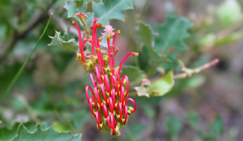
Anglesea Grevillea (Grevillea infecunda) - Rani Hunt
Agricultural interface
To the west of Lavers Hill and Gellibrand, our fuel management activities help slow the spread of fires through the forest. In this Bushfire Moderation Zone, planned burns give fire agencies a chance to contain fires before they spread into wetter forests higher up in the ranges.
The wet forests are zoned as a Planned Burn Exclusion Zone. These forests have Victoria's tallest trees.
Wet forests grow in areas of higher elevation and high rainfall. Wet forests take a long time to recover from fire. They do not need regular fire to maintain ecosystem health.
In the surrounding farm areas, we are testing new fire prediction modelling tools. These tools could help fire agencies and local councils measure the environmental benefits of planned burning on native grasses found along roadsides. They could also show how and where roadside trees could be managed to reduce bushfire risk to communities.
We are working with the University of Melbourne and a local shire to complete this pilot project.
Bushfire Risk Engagement Areas (BREAs)
To protect the things we care about, agencies and communities need to consider ways of reducing bushfire risk across both public and private land.
On public land, our fuel management activities are undertaken across different Fire Management Zones.
To support bushfire risk reduction on private land, we've identified Bushfire Risk Engagement Areas.
Bushfire Risk Engagement Areas in the Otways cover both public and private land and help fire agencies
to prioritise engagement with the community about managing fuels where it can be most effective.
This includes considering a range of actions to reduce bushfire risk.
Where and how we engage with the community will also be informed by current conditions, such as fuel loads and rainfall.
Managing fuels on private and public land begins with a conversation about the benefits and limitations of fuel reduction to meet the needs of our local community and environment.
There is no new legal obligation for landowners within Bushfire Risk Engagement Areas to reduce bushfire fuels on their property.
By working together, land and fire agencies and communities will be able to better protect the things we value from being impacted by bushfire.
For more information or to get involved in fuel management activities on private land, contact your local CFA District.
Fairhaven
Near Fairhaven, we conduct planned burning in stringybark forest on private land. By burning to the north and west of the Fairhaven community we can reduce risk to homes and the local water treatment plant.
FFMVic and CFA work closely together to plan and carry out the burn in consultation with the landowner. Fire agencies also engage with the Fairhaven community so that any issues can be understood and managed locally.
We conduct the burn in autumn, and plan to burn this area every 5-10 years. We burn during mild weather conditions because this vegetation burns readily. Burning when the temperature and winds are low helps us maintain control of the burn. We also consider the wind direction before we conduct the burn to lower the risk of a burn escape.
During the burn, we protect features that have special value such as Aboriginal cultural heritage sites and rare and threatened plant species.
This concludes our Barwon South West Region - Otway Ranges strategy. You can find out more information by downloading the full Bushfire Management Strategy.
Return to the state view to learn about the strategy for the rest of the Barwon South West Region (Far South West), or to see another region's strategy.