About the Barwon South West region - Far South West
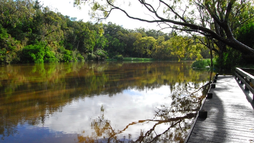
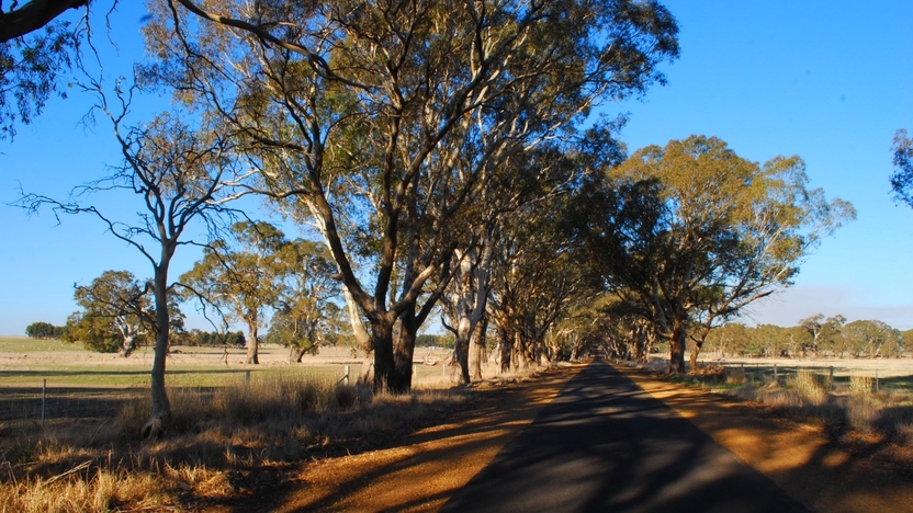
The Barwon South West region - Far South West stretches from Warrnambool to the South Australian border and extends inland to Balmoral, Casterton and Dunkeld. It includes patches of stringybark forest and heathlands and provides important habitat for rare native animals.
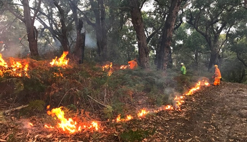
How Victoria manages bushfire risk
In Victoria, we conduct fuel management activities like planned burning, mulching and slashing to reduce the risk of bushfires causing harm to things we care about. We also conduct planned burning to support plants and animals that need fire for their survival.
On this page
Ultimately, we manage bushfire risk to protect the things we care about.
Our bushfire management planning across the state seeks to protect human life, private property, our economy, critical infrastructure, cultural heritage and the environment.
Here in the Barwon South West region - Far South West, we have worked with local communities and consulted scientific data and experts to understand where the most important values and assets are in our region and how to protect them from bushfire.
Here's some examples of the different values and assets we considered in our fuel management planning.
Human life
Communities said human life is the most important thing to protect from bushfire.
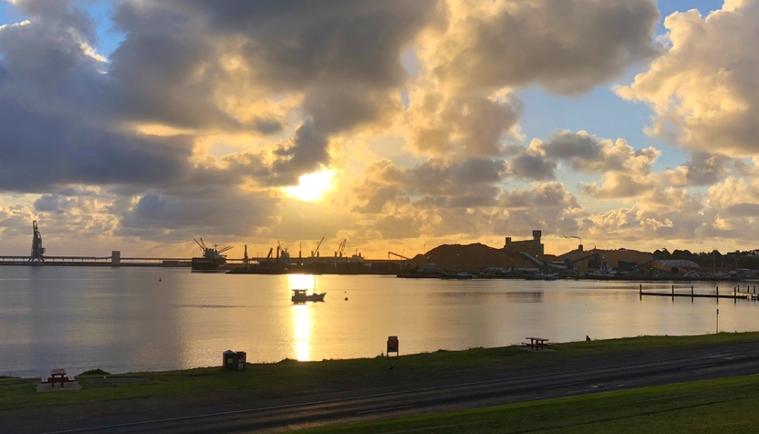
Towns in the area include Narrawong, Nelson and Heywood. The area also attracts thousands of visitors yearly, with many people staying at caravan parks and campsites.
Reducing the risk of bushfire around tourist hotspots is vital for protecting human life, as these areas are surrounded by forest to the north and the west.
Natural environment
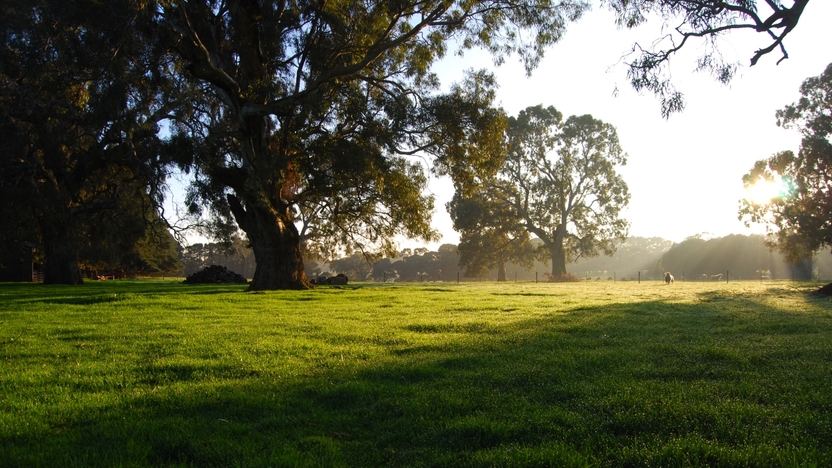
Protecting the natural environment is important to communities of the Far South West. Public land provides important habitat for many species, and ensures it is cared for for generations to come. Habitat also exists on private land.
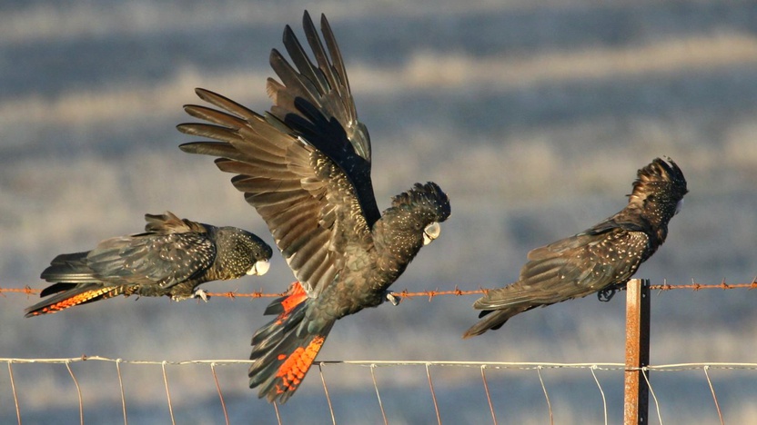
This area includes habitat for the rare and threatened South-eastern Red-tailed Black-cockatoo. It can only eat the seeds of mature Stringybark and Bull-oak trees.
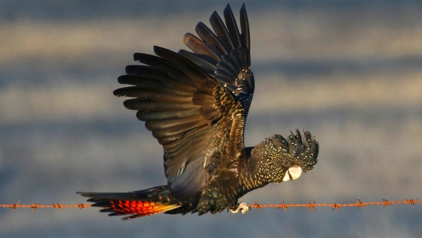
The South-eastern Red-tailed Black-cockatoo (Calyptorhynchus banksii graptogyne) - Mike Sverns
Other species include the Heath Mouse which is also threatened.
Native plants and animals need different amounts of fire to stay healthy. Our fuel management strategy carefully balances the needs of different plants and animals.
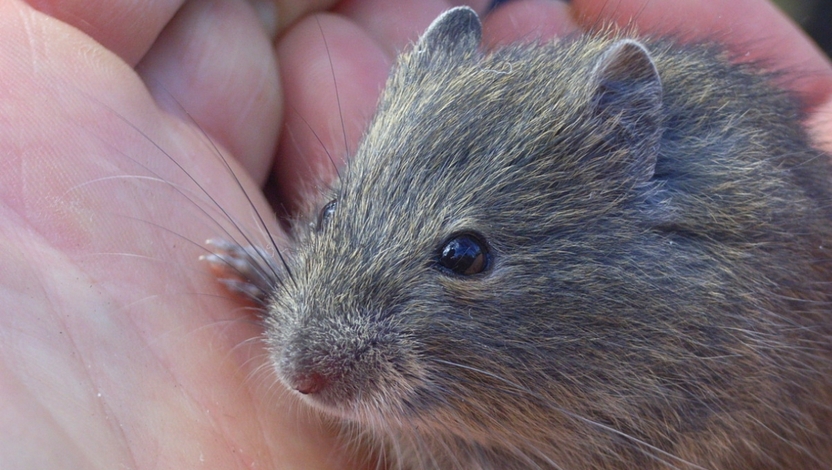
The Heath Mouse (Pseudomys shortridgei) - Richard Hill
Regional economy
The economy and the natural environment both mattered to communities. People wanted fuel management actions to deliver good outcomes for each, rather than choosing one over the other.
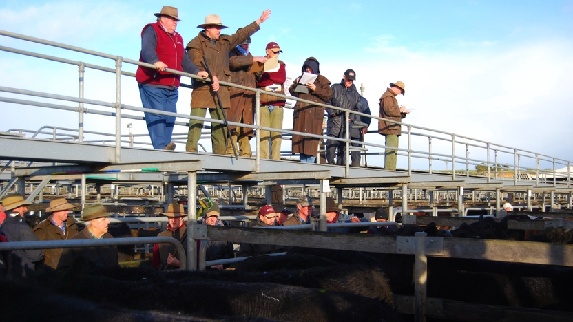
The commercial timber plantation industry and agricultural production are major employers in the region.
By reducing bushfire risk to these sectors, our actions directly support these jobs. They also indirectly support retail jobs in regional cities.
Critical infrastructure
Critical infrastructure in the Barwon South West includes: Power generation and supply assets, gas distribution networks
and Water supply assets.
It also includes major roads, community facilities and telecommunications towers. Critical infrastructure helps communities access essential services.
Communities said critical infrastructure assets were important to protect from bushfire. Targeting our fuel management actions to reduce risk to critical infrastructure assets supports regional communities.
Private property
Protecting private property from bushfire was also very important to communities.
Private property includes homes, agricultural assets and local business assets, such as shops and offices.
Protecting private property helps reduce household losses, which minimises displacement and disruption to communities. This supports people to stay linked to their neighbourhood and helps communities keep running normally.
Human health and wellbeing
In the Far South West, communities told us that it’s important to protect human health and wellbeing.
Agencies that organise and provide disaster relief services helped us test new ways to measure the effects of bushfire on community wellbeing.
By focussing our efforts on reducing risks to human life and private property, we can also reduce the effects of bushfire on people and their health and wellbeing.
Our bushfire history
This section contains information regarding past bushfires which some readers may find upsetting. Click to skip ahead to bushfire risk in our region or our fuel management strategy.
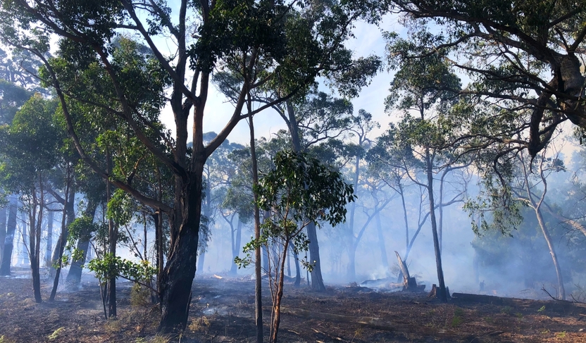
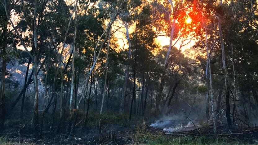
In the Far South West, our most damaging fires happen when lightning causes multiple fires to start on the same day.
These fires can rapidly spread into townships or commercial pine plantations when strong westerly winds set in behind cold fronts.
These fire behaviour patterns help us understand which communities might be at risk if a fire started. They also tell us where fuel management programs are useful for protecting townships, economies, or important habitat for plants and animals.
Black Friday
The 1939 Black Friday fires affected Heywood, Portland and areas west of those townships through to the South Australian border.
Newspaper records show the fire was fanned by strong northerly winds, estimated at up to 60 miles per hour.
The fires caused major losses of homes, sawmills and livestock.
Budj Bim Cultural Landscape
In 2019, lighting started many fires in the Far South West. One of these fires threatened the Budj Bim Cultural Landscape.
Fire agencies worked with local Aboriginal communities and cultural heritage experts to decide how best to put the fire out. This included avoiding using earth moving equipment. This minimised harm to important Aboriginal cultural sites and land formations.
The Budj Bim Cultural Landscape is a UNESCO World Heritage Site. The site is recognised as one of the world’s most extensive and oldest aquaculture systems.
Bushfire risk in our region
This map shows the risk of house loss in the Far South West which is part the Barwon South West region. The map compares where houses could be destroyed by bushfire across the whole region.
Different shades represent different levels of risk. As the shades progress from yellow through red to purple, more and more houses are potentially destroyed.
The purple areas have the highest risk of house loss. More houses could potentially be destroyed by bushfire in these areas than in any other areas in this region.
Computer simulations are used to help us estimate houses lost from bushfires. The simulations measure how damaging bushfires could be in different locations. They assume that the fuels in the landscape have increased to the highest level.
This helps us plan where, how often and how much fuel management we do to reduce risks to communities over years, or even decades.
This map does not reflect any recent bushfires or activities that could change the risk in the region. Importantly, this map shows where there is potential for a bushfire to destroy more houses compared to other parts of the region. It does not show risk to individual houses.
Higher risk area for Barwon South West region - Far South West: Nelson
Nelson is surrounded by forest to the north, and north-west. Burning stringybark trees produce embers that cause fires to spread quickly. On hot and very windy days, embers may cause fire to cross the Glenelg River. This could cut off the town bridge and make it hard for people to leave.
Lower risk area for Barwon South West region - Far South West: Coleraine
Coleraine is surrounded by farmed grassland. If a fire starts in a grassland, it can spread very quickly. However, grass fires produce less embers and burn for less days compared to forest fires. These factors mean that there is usually less house loss in grassland areas.
Our fuel management strategy
By understanding what communities care about, where bushfires have happened before and analysing what areas in the Barwon South West region - Far South West are most at risk, we can create a strategy. This strategy tells agencies where, how much and how often to conduct fuel management activities to reduce bushfire risk.
We classify patches of public land as different Fire Management Zones - Asset Protection Zones,
Bushfire Moderation Zones,
Landscape Management Zones
and Planned Burning Exclusion Zones.
In each of these zones we manage fuels differently in terms of the frequency and intensity of fuel management activities like planned burning.
Where we conduct fuel management each year is determined by a range of factors, including fuel loads and weather conditions, such as rainfall.
'Fuel' is any grass, leaf litter, twigs, bark and other live vegetation which can burn. Fuel builds up at different rates in different areas depending on how fast the vegetation grows compared to how fast it decomposes.
The way we conduct fuel management in the different types of Fire Management Zones on public land helps us to reduce the intensity, severity and spread of bushfires across the landscape. This contributes to reducing the risk of bushfires impacting things we care about.
We monitor the success of our fuel management program and publish the results in our yearly Fuel Management Report.
Townships and tourists
To protect human life, private property and community assets from the impacts of bushfire, we target fuel management activities around towns such as Bolwarra.
In these Asset Protection Zones, we aim to greatly reduce fine fuels through regular planned burning as well as mulching.
This reduces risk to life and property for communities located to the south and the east of the Cobboboonee National Park.
By conducting fuel management in these areas, we also support the local economy by protecting Portland. Portland is a large regional centre with key services and facilities for communities in the Far South West.
We bolster protection for these communities by burning behind the Asset Protection Zone near the National Park in a designated Bushfire Moderation Zone.
Here, we conduct cooler burns roughly every 10 years. This reduces the chance of a very large and hot fires developing in the forested area.
This approach helps to protect the habitat of rare and threatened species like the Heath Mouse which needs some fire to regenerate.
These planned cooler burns also reduce the chance of a very large and hot fire developing in the forested area. This protects the food source of the South-eastern Red-tailed Black Cockatoo from being destroyed by a very large uncontrolled fire.
South-eastern Red-tailed Black-cockatoo
This area includes habitat for the rare and threatened South-eastern Red-tailed Black-cockatoo, which can only eat the seeds of mature stringybark trees and buloke.
This is the only area in Australia where this bird species survives.
Fuel management in this area carefully balances the protection of the birds’ habitat, with reducing bushfire risk to nearby communities.
'South-eastern Red-tailed Black Cockatoos (Calyptorhynchus banksii graptogyne) - Mike Sverns
We create both Bushfire Moderation Zones
and Landscape Management Zones in this area. Our actions in these zones work together to balance the overall risks.
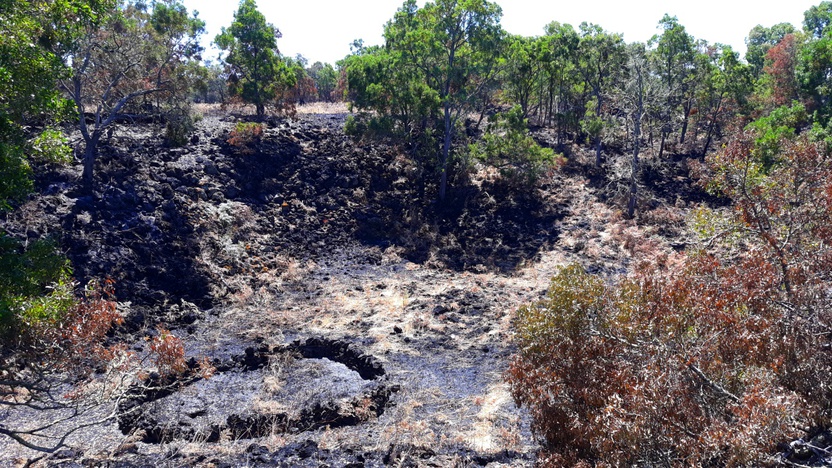
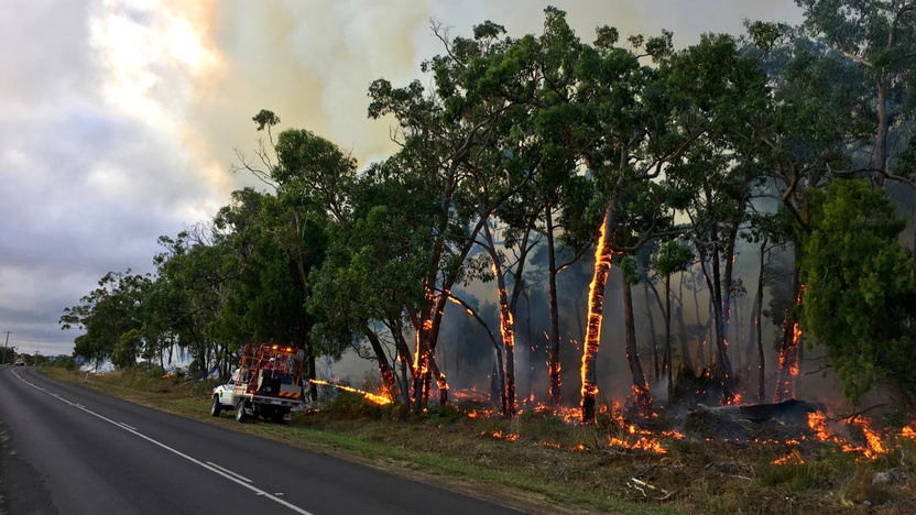
We conduct mosaic pattern burns in selected areas, roughly every 15 years. These are cool burns that do not burn the tree canopy.
We burn other selected blocks in the forest roughly every ten years. This helps reduce the risk of fires that start due to lightning, getting very large and very hot. Other areas of the forest are not targeted for any planned burns to take place in a human lifetime.
Plantations
The commercial timber plantation industry is a major employer in the Far South West.
The industry also assists fire agencies and the community by allowing its firefighting equipment and staff to help respond to fires. Reducing bushfire risk to the plantations helps protect local jobs.
To the north and west of the timber plantations, we have created a Bushfire Moderation Zone. Here, we burn selected blocks of forest roughly every 15 years. This reduces the chance of a large bushfire spreading in the forested area and damaging a major local industry.
In this location, many fires start from lightning strikes in remote areas. Keeping fires small, or being able to disrupt their spread through the forest is also important.
This reduces the impact of bushfire on unique habitats. Keeping fires small also helps reduce the impact of bushfire on tourism. The tourism sector depends on a healthy and attractive natural environment.
Bushfire Risk Engagement Areas (BREAs)
To protect the things we care about, agencies and communities need to consider ways of reducing bushfire risk across both public and private land.
On public land, our fuel management activities are undertaken across different Fire Management Zones.
To support bushfire risk reduction on private land, we’ve identified Bushfire Risk Engagement Areas.
Bushfire Risk Engagement Areas in the Far South West cover both public and private land and help fire agencies to prioritise engagement with the community about managing fuels where it can be most effective. This includes considering a range of actions to reduce bushfire risk.
Where and how we engage with the community will also be informed by current conditions, such as fuel loads and rainfall.
Managing fuels on private and public land begins with a conversation about the benefits and limitations of fuel reduction to meet the needs of our local community and environment.
There is no new legal obligation for landowners within Bushfire Risk Engagement Areas to reduce bushfire fuels on their property.
By working together, landowners and agencies and communities will be able to better protect the things we value from being impacted by bushfire.
For more information or to get involved in fuel management activities on private land, contact your local CFA District.
Portland
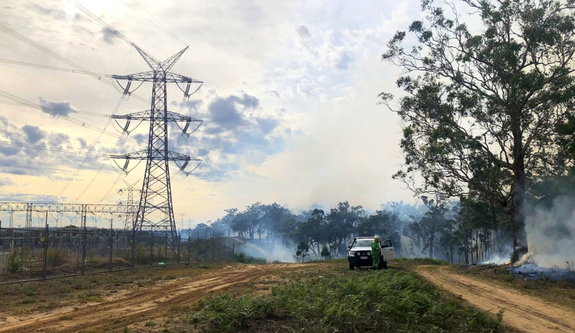
Conducting fuel management activity across both public and private land helps protect assets and services that are critical to regional communities. One place we do this is around a power substation near Portland. The substation is on private land that is surrounded by public forested land.
FFMV and CFA work together to conduct this planned burn. We work closely with the power company and the private landowner to understand and address any issues or concerns at the local level.
We mulch the ground fuels and then use fire to burn the bark off trees. This reduces the amount of vegetation around the substation; and reduces the likelihood of a fire spreading into the tree canopy. By protecting the substation from bushfire risk, our fuel management actions protect the local power supply, which supports residents, commercial businesses and industry.
This concludes our Barwon South West Region - Far South West strategy. You can find out more information by downloading the full Bushfire Management Strategy.
Return to the state view to learn about the strategy for the rest of the Barwon South West Region (Otways), or to see another region's strategy.