About the Gippsland region
The Gippsland region covers all of southeast Victoria, between the Great Divide and the coast. It is the most forested region of Victoria, with significant natural resources, primary production and tourism industries.
How Victoria manages bushfire risk
In Victoria, we conduct fuel management activities like planned burning, mulching and slashing to reduce the risk of bushfires causing harm to things we care about. We also conduct planned burning to support plants and animals that need fire for their survival.
On this page
Identifying what we care about
Ultimately, we manage bushfire risk to protect the things we care about.
Our bushfire management planning across the state seeks to protect human life, private property, our economy, critical infrastructure, cultural heritage and the environment.
Here in the Gippsland region, we have worked with local communities and consulted scientific data and experts to understand where the most important values and assets are in our region and how to protect them from bushfire.
Here's some examples of the different values and assets we considered in our fuel management planning.
Human life
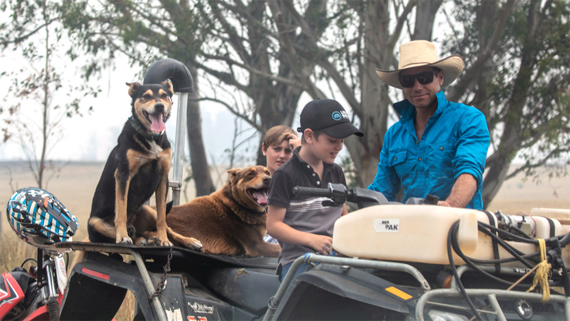
Protecting human life was identified by the Gippsland community as the most important value in bushfire management. Many of Gippsland’s residents live in larger towns like Warragul, Traralgon, Wonthaggi, Sale and Bairnsdale. Another 40% live in towns of fewer than 500 people like Rawson, Noojee, Nowa Nowa, Buchan and Omeo.
During holiday periods, some coastal towns host large numbers of tourists.
Understanding where residents and visitors are in Gippsland is key to protecting lives from bushfire.
Natural environment
Gippsland's unique natural landscapes, plant and animal species are very important to our residents and visitors. Public land provides important habitat for many species, and ensures it is cared for for generations to come. Habitat also exists on private land.
Gippsland also boasts many iconic landscapes features, including the Gippsland Lakes, Wilsons Promontory and the Snowy River.
Environmental data, including the Victorian Biodiversity Atlas, are an important source of information for fuel management planning.
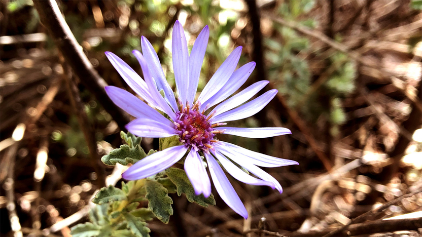
Some species occur in isolated locations, nowhere else in Victoria, like the Marble Daisy-bush, Eastern Bristlebird and New Holland Mouse.

Other species are more widespread, like the threatened Long Footed Potoroo
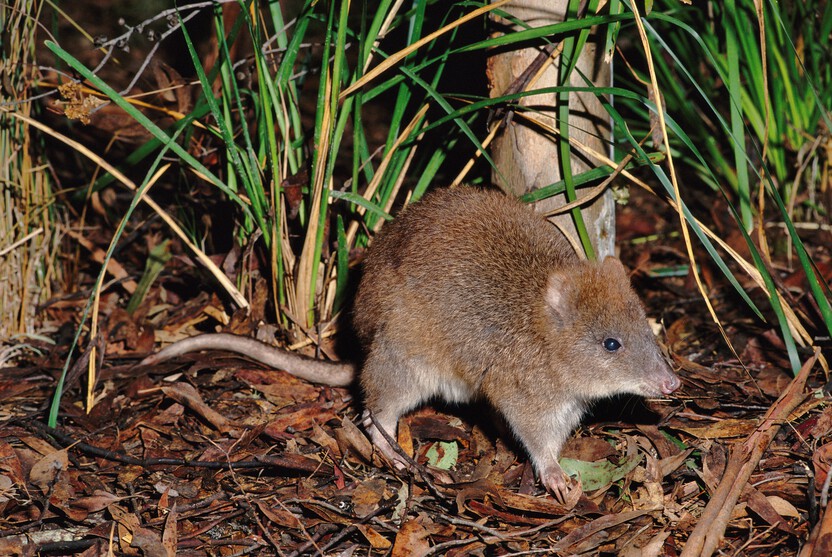
The threatened Long Footed Potoroo - David Watts
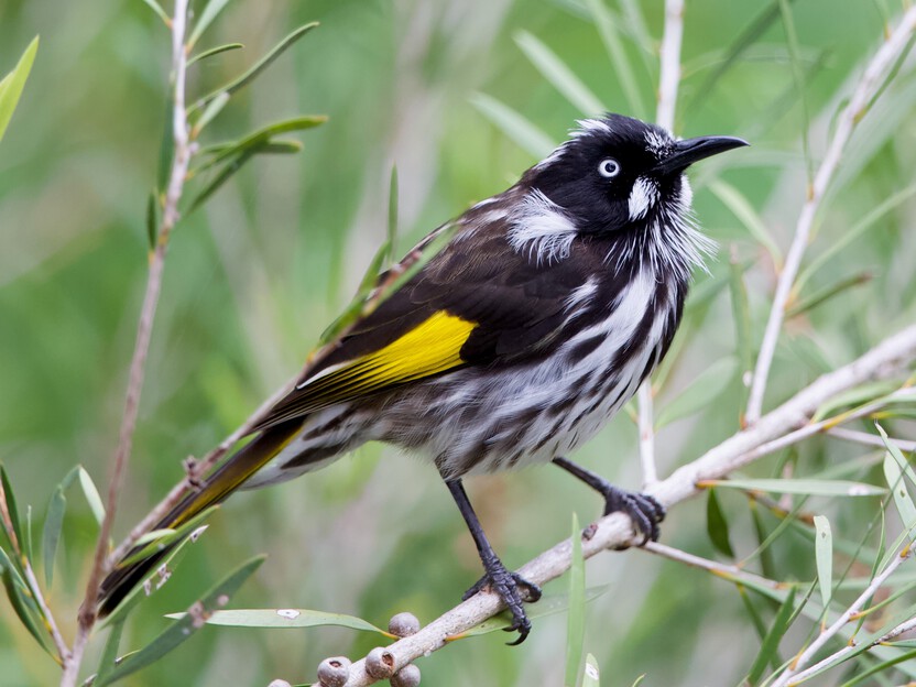
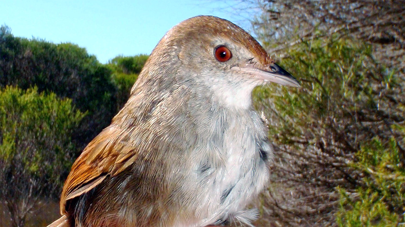
The New Holland Honeyeater is a common species in Gippsland - John Hutchison, Birdlife East Gippsland
Regional Economy
The social and economic wellbeing of many Gippsland communities is underpinned by Gippsland’s natural resources. These natural resources support industries like agriculture, forestry, power generation and tourism.
Protecting these natural resources and industries from bushfire is important for the livelihoods of many Gippsland residents in both large and small towns.
Critical infrastructure
We identified critical infrastructure in our region that needs to be protected from bushfire.
Critical infrastructure in Gippsland provides residents and other Victorian communities with essential services, like energy production and water storage.
Our critical infrastructure also includes major roads, such as the Princes Highway - a vital link for transporting goods and services within and beyond Gippsland.
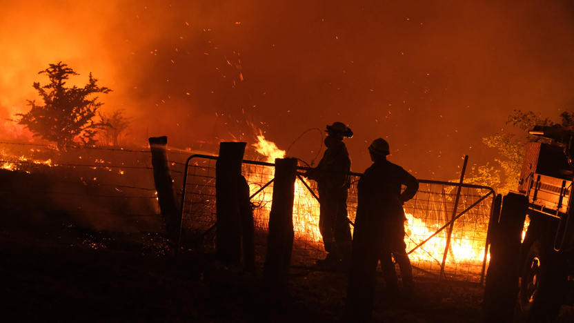
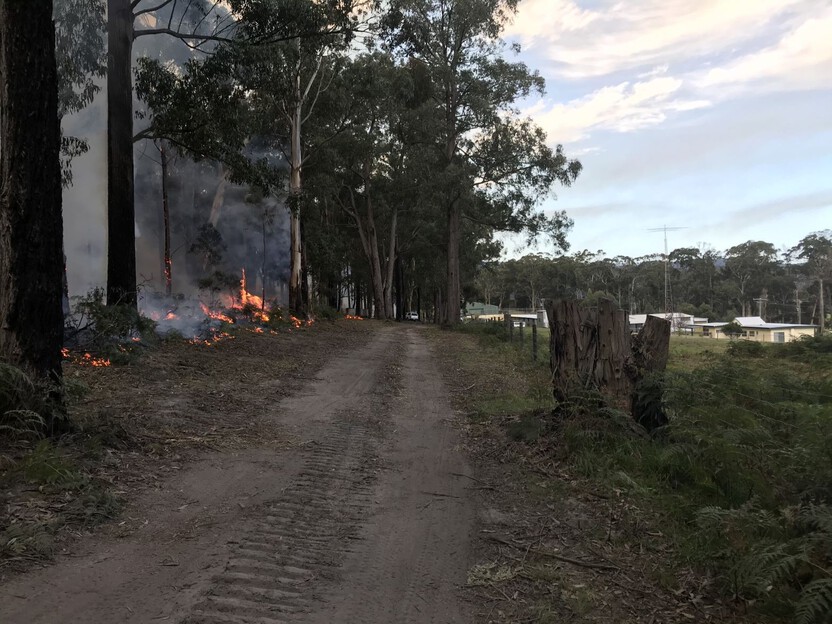
Our bushfire history
This section contains information regarding past bushfires which some readers may find upsetting. Click to skip ahead to bushfire risk in our region or our fuel management strategy.
Gippsland has a long history of large bushfires. On the worst fire-weather days, hot north-westerly winds cause bushfires to grow rapidly, pushing the fire-front downwind. A wind-change can then trigger a sudden shift in fire behaviour, with the entire flank of the fire becoming a much larger fire-front. In dry years, multiple fires join into ‘campaign’ fires that continue for months.
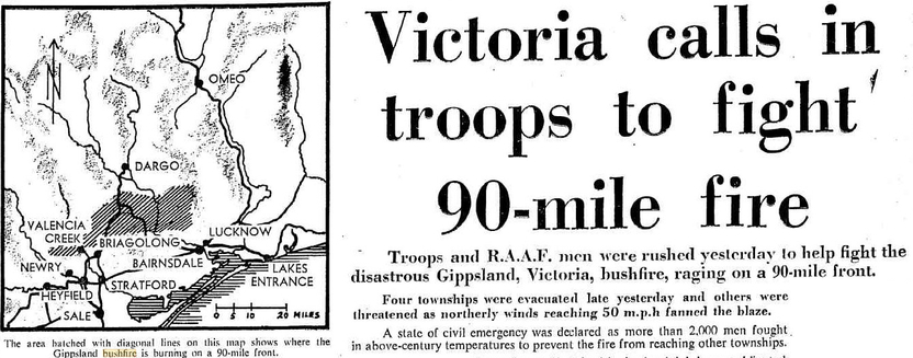
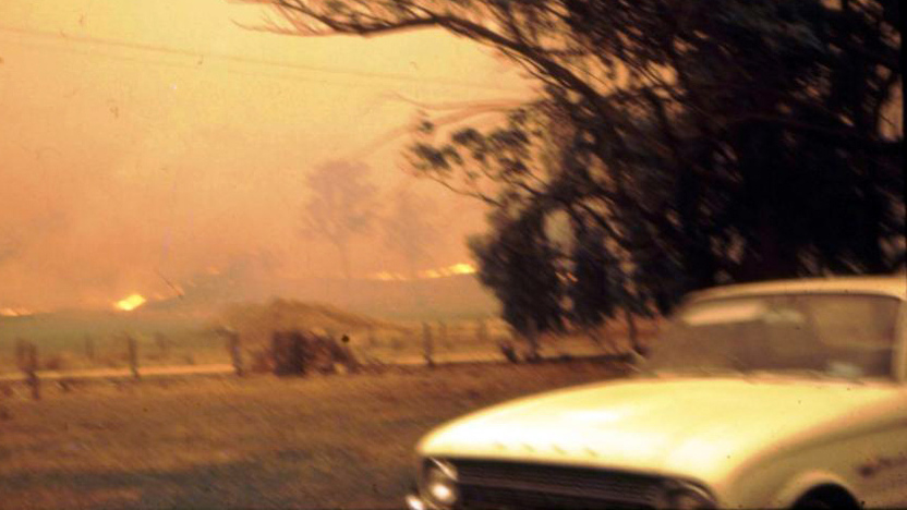
1965 bushfire season
In February 1965, lightning and hot dry weather caused a series of fires to start across Gippsland.
The largest fire started near Valencia Creek and spread quickly over following days, joining with other fires and impacting towns such as Coongulla, Maffra, Newry, Boisdale and Briagolong.
By mid-March, when rain halted the fire, it had burnt houses and farms for almost 150km, reaching Sarsfield, Tambo Upper, Bruthen and Tambo Crossing.
A recent community engagement project reconstructed this event from local knowledge and archival records.
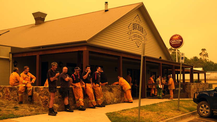
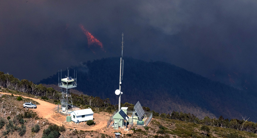
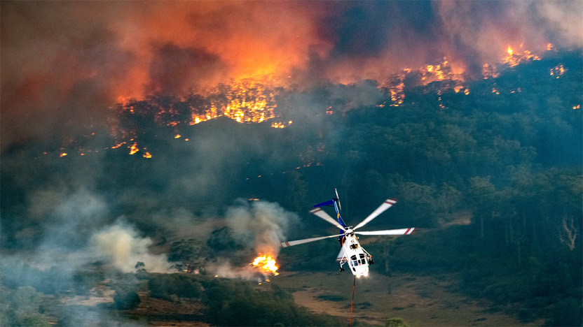
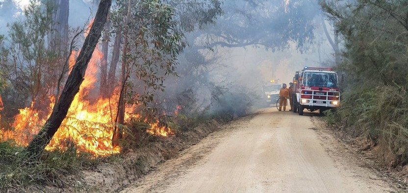
2019-20 bushfire season
By late 2019, East Gippsland had experienced its driest three-year period on record, and multiple bushfires were burning across the landscape.
By the end of December the bushfires had burnt more than 30,000 hectares of forest in Gippsland, and lightning strikes had caused a number of new fires across the Victorian alps.
Hot, dry and windy conditions on New Year’s Eve caused the fire to grow rapidly to the south-east. The wind change that followed pushed multiple fire fronts to the north-east.
Most of the fires joined to become a bushfire complex of more than a million hectares.
Many communities were isolated, hundreds of homes were lost, and thousands of kilometres of roads were blocked by fallen trees.
Thousands of emergency workers and volunteers worked for months to contain fires and reopen access roads, until the fires were brought under control in March.
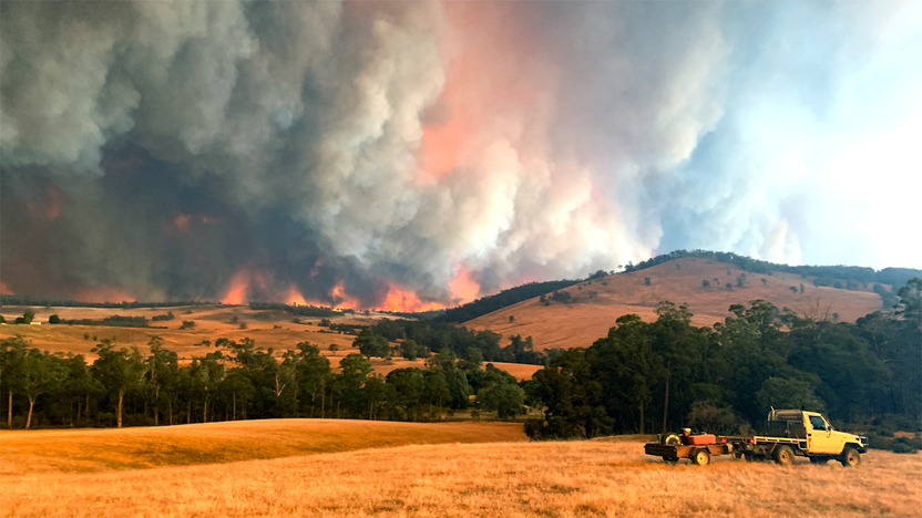
Bushfire risk in our region
This map shows the risk of house loss in the Gippsland region. It compares where houses could be destroyed by bushfire across the region.
Different shades represent different levels of risk. As the shades progress from yellow through red and purple, more and more houses are potentially destroyed.
The purple areas have the highest risk of house loss. More houses could potentially be destroyed by bushfire in these areas than in any other areas in this region.
Computer simulations are used to help us estimate houses lost from bushfires. The simulations measure how damaging bushfires could be in different locations. They assume that the fuels in the landscape have increased to the highest level.
This helps us plan where, how often and how much fuel management we do to reduce risks to communities over years, or even decades.
This map does not reflect any recent bushfires or activities that could change the risk in the region. Importantly, this map shows where there is potential for a bushfire to destroy more houses compared to other parts of the region. It does not show risk to individual houses.
Higher risk areas in Gippsland
The highest risk places in Gippsland are towns bordered by forest, such as Noojee, Erica, Mirboo North, Bruthen, Cann River and Mallacoota.
Large areas of forest can allow fires to become large and intense before they impact on communities.
Other, smaller settlements near forests may be equally likely to be impacted by bushfire, but have fewer houses and people at risk.
Lower risk areas in Gippsland
The larger population centres in Gippsland are typically surrounded by cleared farmland, including Warragul, Leongatha, the Latrobe Valley, Bairnsdale and Sale. Dangerous grass fires can still occur in such areas, but are less likely to destroy large numbers of houses.
Our fuel management strategy
By understanding what communities care about, where bushfires have happened before and analysing what areas in the Gippsland region are most at risk, we can create a strategy. This strategy tells agencies where, how much and how often to conduct fuel management activities to reduce bushfire risk.
We classify patches of public land as different Fire Management Zones - Asset Protection Zones,
Bushfire Moderation Zones,
Landscape Management Zones
and Planned Burning Exclusion Zones.
In each of these zones we manage fuels differently in terms of the frequency and intensity of fuel management activities like planned burning.
Where we conduct fuel management each year is determined by a range of factors, including fuel loads and weather conditions, such as rainfall.
'Fuel' is any grass, leaf litter, twigs, bark and other live vegetation which can burn. Fuel builds up at different rates in different areas depending on how fast the vegetation grows compared to how fast it decomposes.
The way we conduct fuel management in the different types of Fire Management Zones on public land helps us to reduce the intensity, severity and spread of bushfires across the landscape. This contributes to reducing the risk of bushfires impacting things we care about.
We monitor the success of our fuel management program and publish the results in our yearly Fuel Management Report.
Heyfield and Surrounds
Asset Protection Zones are situated on public land where it meets private land, north and west of the Heyfield area. We reduce fuels in these areas using intensive planned burning every 5 to 8 years.
These Asset Protection Zones are backed up by surrounding Bushfire Moderation Zones, which are typically burnt every 8 to 12 years. Fuel reduction in these zones will slow down bushfires and reduce the number of embers (burning bark and leaves) that bushfires produce.
The Landscape Management Zone provides for flexibility in fuel treatment and added consideration of the fire regimes needed by local plants and animals.
In Gippsland, roughly half of planned burning takes place in Asset Protection or Bushfire Moderation Zones each year, and half in Landscape Management Zones.
Lakes Entrance Hinterland
To the north of Lakes Entrance and Lake Tyers is the Colquhoun / Boyanga Gidi State Forest. Fuels in this area create risk to those communities as well as Nowa Nowa, Wairewa, Kalimna and Swan Reach and to assets such as the Princes Highway.
This is also an important forest for environmental reasons, being home to threatened animals, including forest owls and the White-bellied Sea-eagle, and vulnerable plant species such as endangered orchids.
Fire Management Zoning in this area reflects the need to both reduce bushfire risk to communities and support the plants and animals that live there.
As a result, Asset Protection Zones are placed on the interface between forest and more densely-settled areas.
Bushfire Moderation Zones border areas of lower population density, and the Princes Highway.
The interior of the State Forest and areas of high environmental value surrounding the upper reaches of Lake Tyers are Landscape Management Zones.
Errinundra Plateau
Large sections of the Errinundra National Park are designated as Planned Burning Exclusion Zones.
The main vegetation type here is Wet Forest. For most of the year the fuels in this area are very damp, so it’s not feasible to conduct planned burning.
The area also has many significant environmental values, including Cool Temperate Rainforest and highly localised species such as the Errinundra Shining Gum, the Errinundra Plum Pine, and the East Gippsland Galaxias.
Given that these values would not benefit from planned burning and that burning would generally not be achievable, we do not undertake burning in this area.
Bushfire Risk Engagement Areas (BREAs)
To protect the things we care about, agencies and communities need to consider ways of reducing bushfire risk across both public and private land.
On public land, our fuel management activities are undertaken across different Fire Management Zones.
To support bushfire risk reduction on private land, we’ve identified Bushfire Risk Engagement Areas.
Bushfire Risk Engagement Areas in Gippsland cover both public and private land and help fire agencies
to prioritise engagement with the community about managing fuels where it can be most effective.
This includes considering a range of actions to reduce bushfire risk.
Where and how we engage with the community will also be informed by current conditions, such as fuel loads and rainfall.
Managing fuels on private and public land begins with a conversation about the benefits and limitations of fuel reduction to meet the needs of our local community and environment.
There is no new legal obligation for landowners within Bushfire Risk Engagement Areas to reduce bushfire fuels on their property.
By working together, land and agencies and communities will be able to better protect the things we value from being impacted by bushfire.
For more information or to get involved in fuel management activities on private land, contact your local CFA District.
Won Wron
A cross-tenure planned burn was conducted 7km south west of Won Wron, across both public and private land. The burn reduced bushfire risk to local properties and community infrastructure, a local South Gippsland water treatment pond. It supports other fuel reduction works that occur within the neighbouring Strezlecki State Forest.
The first step of the two year plan was to target ‘extreme bark hazard’. This involved burning excess bark from established trees to lessen the likelihood of fire in a planned burn running up the trunk and entering the canopy or spotting. This enabled a safer delivery of the second step, and opened up more days on which conditions were appropriate and safe to conduct it.
The second and final step was completed as a partnership between FFMVic and CFA. This step involved putting a slow moving fire into the landscape to reduce the fuel load on the ground. Following the successful delivery of both steps, bushfire risk to the local area has been reduced.
This concludes our Gippsland region strategy. You can find out more information by downloading the full Bushfire Management Strategy.
Return to the state view to explore other regional strategies.