About the Metropolitan region
The Metropolitan Region includes greater metropolitan Melbourne, extensive grasslands in its west, and large areas of forest in its east. Our region covers 3.96% of Victoria: 21% of the region is public land and 79% is privately owned. Over 70% of Victorians live in the Metropolitan Region.
How Victoria manages bushfire risk
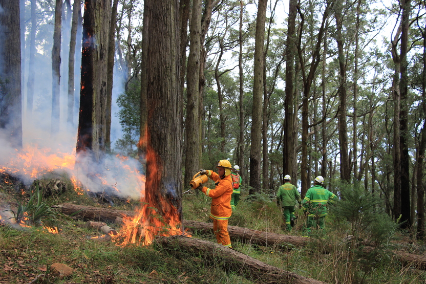
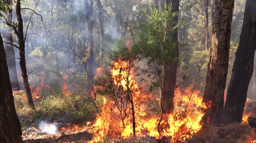
In Victoria, we conduct fuel management activities like planned burning, mulching and slashing to reduce the risk of bushfires causing harm to things we care about. We also conduct planned burning to support plants and animals that need fire for their survival.
On this page
Ultimately, we manage bushfire risk to protect the things we care about.
Our bushfire management planning across the state seeks to protect human life, private property, our economy, critical infrastructure, cultural heritage and the environment.
Here in the Metropolitan region, we have worked with local communities and consulted scientific data and experts to understand where the most important values and assets are in our region and how to protect them from bushfire.
Here's some examples of the different values and assets we considered in our fuel management planning.
Human life
Communities identified human life and property as the most important things we need to protect from bushfire.
Over four million Victorians live in Metropolitan region within a diverse array of townships that have different needs for managing bushfire risk.
For example, some communities live close to forested areas in and around the Dandenong Ranges, Warrandyte and the Yarra Valley,
whereas others live in more open areas, such as the western grasslands. We carefully consider the needs of our different communities in our bushfire management planning.
Natural environment
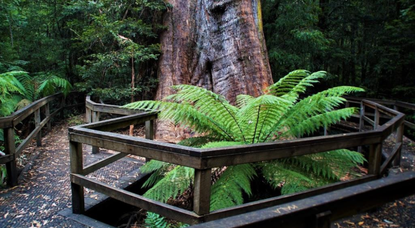
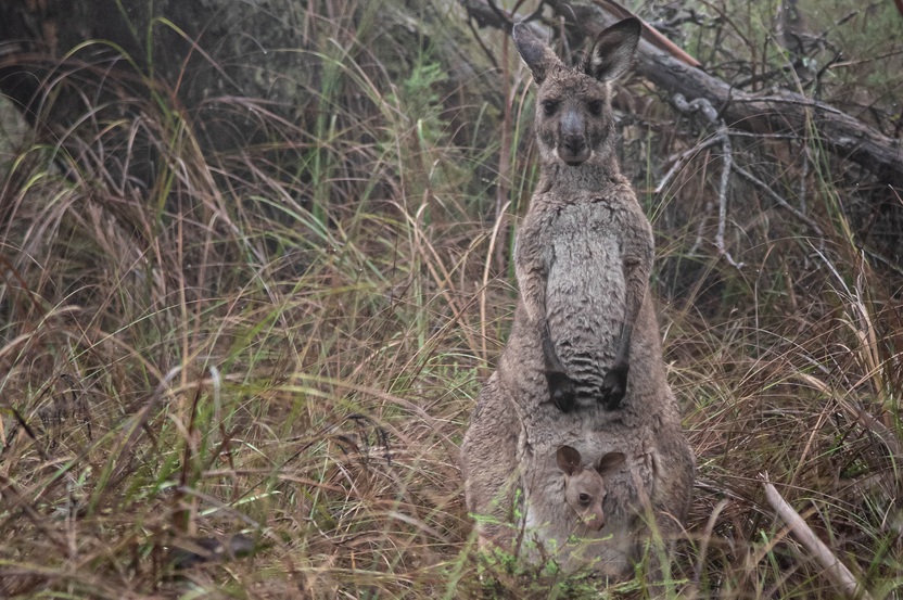
Protecting the natural environment is important to communities in the region. Public land provides important habitat for many species, and ensures it is cared for for generations to come. Habitat also exists on private land.
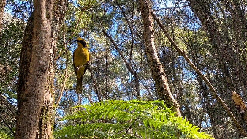
Iconic and threatened/endangered species such as the Helmeted Honeyeater,
Leadbeater's Possum,
and Greater Glider call this region home.
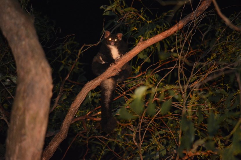
Other non-threatened species such as the Eastern Pygmy Possum also live in our region.
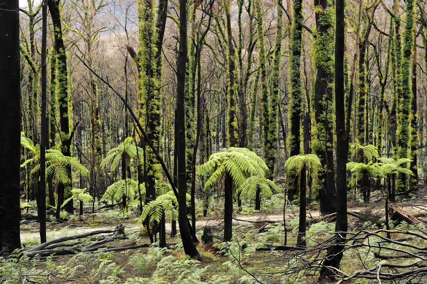
We carefully consider where, how much and how often we burn to promote the health of plants and animals. Some species are dependent on fire for their survival, while other species can be negatively impacted by fire.
For example, we burn regularly in the western grasslands to promote species diversity.
and in the wet Mountain Ash forest, we don't burn at all.
Regional economy
Tourism is a major industry in the region. The Mornington Peninsula, Dandenong Ranges and Yarra Valley attract around 15 million domestic and international visitors every year. This contributes around $2 billion to our economy.
We also target our fuel management to reduce bushfire risk to these tourism hotspots to maintain a healthy and attractive environment that can support tourism and local economies.
Critical infrastructure
Protecting our critical infrastructure from bushfire risk is essential for maintaining the health and safety of all Victorians.
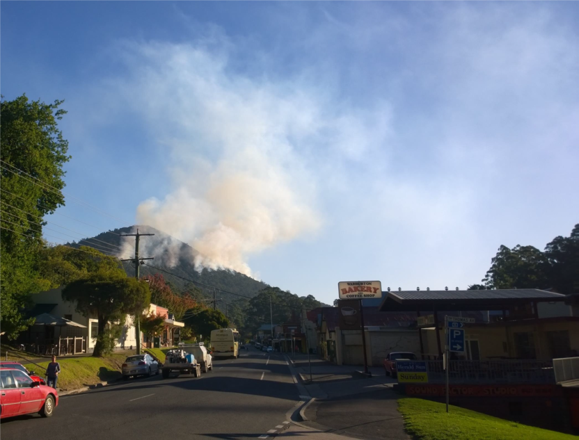
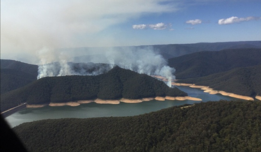
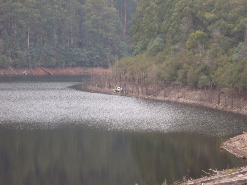
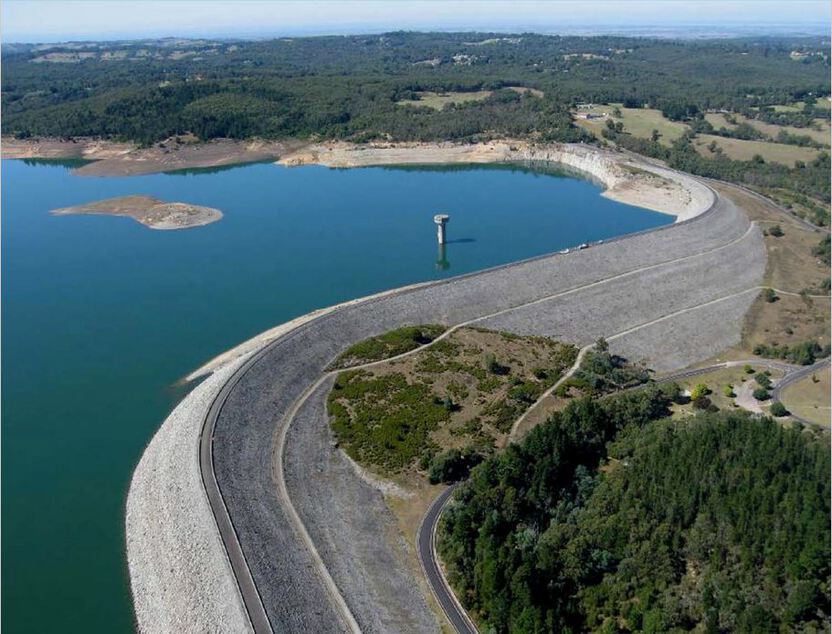
We have seven water storages and catchments in the region that provide fresh water to 4.5 million Victorians.
Fuel management in water catchments reduces the risk of bushfire contamination to our water supply.
 Cultural heritage
Our region includes thousands of Aboriginal cultural heritage sites, such as artefact scatters, object collections, earth features, scarred trees, shell middens, stone features and ancestral remains.
We work closely with Traditional Owner groups to implement protection measures and avoid harm to these important cultural values.
We also support Traditional Owner groups to heal and manage Country through cultural burning.
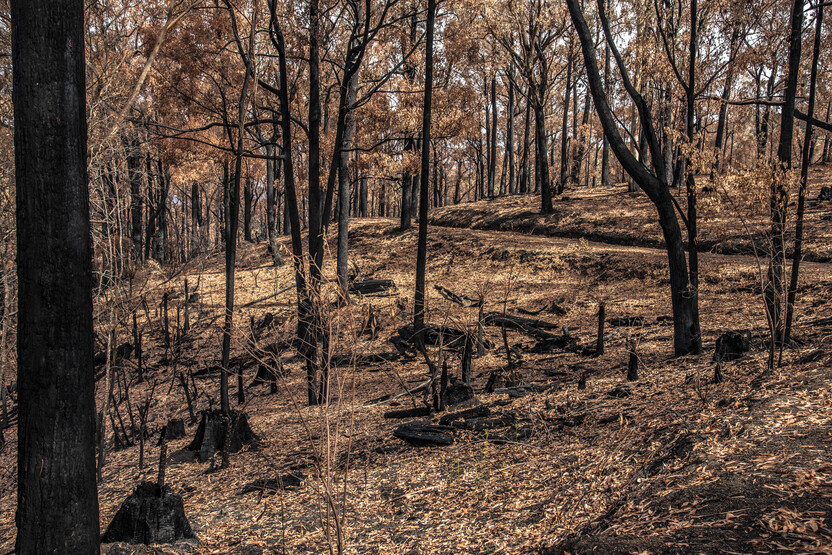
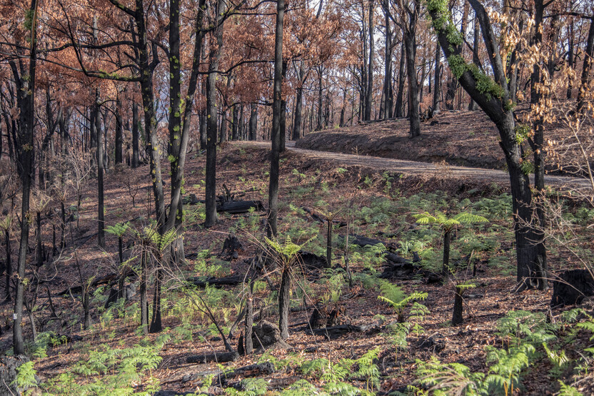
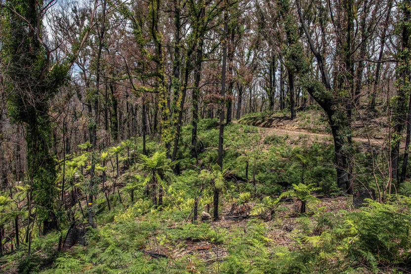
Our bushfire history
This section contains information regarding past bushfires which some readers may find upsetting. Click to skip ahead to bushfire risk in our region or our fuel management strategy.
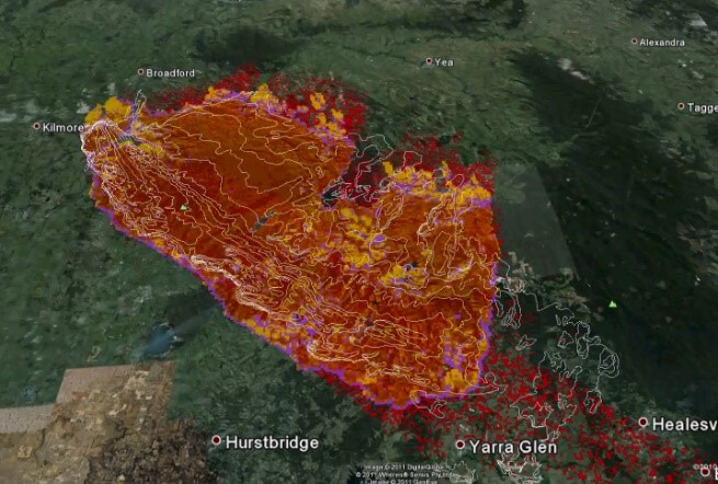
This map shows the bushfire history in the Metropolitan region from 1983-2020.
Bushfire history and fire prediction modelling tell us that our most dangerous bushfires are likely to start in the north, often entering from Hume region.
These bushfires follow a pattern of being dominated by hot north-westerly winds, followed by a cool afternoon wind change from the south west.
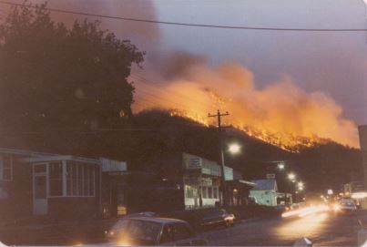
Ash Wednesday
The 1983 Ash Wednesday bushfires followed typical fire behaviour patterns. The fire was dominated by strong north-westerly winds, and rapidly spread north east under the influence of the cold front that brought south-westerly winds.
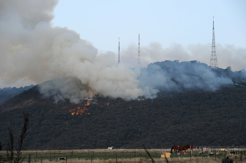
Beaconsfield Upper, Cockatoo and Warburton experienced combined losses of 27 lives and 572 houses.
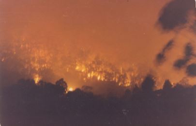
Black Saturday
The 2009 Black Saturday Bushfires were the most devasting in Victoria's recorded history. These fires impacted many townships in the Metropolitan region. The fires followed typical fire behaviour patterns for the area. This state-wide fire event caused the loss of 173 lives and more than 2,000 houses in Victoria.
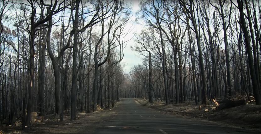
Bunyip and Cambarville
The 2019 Bunyip and Cambarville bushfires were caused by a dry band of lightning in late summer and spread rapidly under the influence of northerly winds. Both bushfires impacted large areas of threatened species habitat, and the Bunyip fire impacted many houses and sheds.
This fire event started through multiple lightning strikes igniting bushfires in Bunyip State Forest on the 1st of March 2019.
The following morning, several of the bushfires merged together and progressed further south.
Later that day, extreme weather conditions resulted in all active bushfires in the area merging into a large fire complex that rapidly progressed south.
On March 3rd, the fire expanded on each front and progressed further into private property to the south.
North-westerly winds then pushed the fire further to the south east.
On the morning of the 4th of March, the bushfire complex expanded on all fronts and the fire crossed over the Princess Highway and the transmission lines that provide power to suburban Melbourne
The fire complex then progressed further north past the transmission lines.
Firefighters continued to battle the blaze for several days. It was declared 'contained' on March 13, 2020.
Bushfire risk in our region
This map shows the risk of house loss in the Metropolitan region. It compares where houses could be destroyed by bushfire across the region.
Different shades represent different levels of risk. As the shades progress from yellow through red to purple, more and more houses are potentially destroyed.
The purple areas have the highest risk of house loss. More houses could potentially be destroyed by bushfire in these areas than in any other areas in this region.
Computer simulations are used to help us estimate houses lost from bushfires. The simulations measure how damaging bushfires could be in different locations. They assume that the fuels in the landscape have increased to the highest level.
This helps us plan where, how often and how much fuel management we do to reduce risks to communities over years, or even decades.
This map does not reflect any recent bushfires or activities that could change the risk in the region. Importantly, this map shows where there is potential for a bushfire to destroy more houses compared to other parts of the region. It does not show risk to individual houses.
Higher risk area: Dandenong Ranges
We consider the Dandenong Ranges to be a high bushfire risk area. There are highly populated residential areas among the forest, few escape routes and densely forested areas to the north and west of the area. Fire history and our fire modelling tells us many fires can impact the Dandenong Ranges and cause significant house loss.
Lower risk area: Western grasslands
In comparison, the Western grasslands within our region are lower risk, as they are dominated by grass not forest. While grassfires burn quickly, compared to forest fires, prediction modelling and fire history indicates they are less likely to result in house loss.
Our fuel management strategy
By understanding what communities care about, where bushfires have happened before and analysing what areas in the Metropolitan region are most at risk, we can create a strategy. This strategy tells agencies where, how much and how often to conduct fuel management activities to reduce bushfire risk.
We classify patches of public land as different Fire Management Zones - Asset Protection Zones,
Bushfire Moderation Zones,
Landscape Management Zones
and Planned Burning Exclusion Zones.
In each of these zones we manage fuels differently in terms of the frequency and intensity of fuel management activities like planned burning.
Where we conduct fuel management each year is determined by a range of factors, including fuel loads and weather conditions, such as rainfall.
'Fuel' is any grass, leaf litter, twigs, bark and other live vegetation which can burn. Fuel builds up at different rates in different areas depending on how fast the vegetation grows compared to how fast it decomposes.
The way we conduct fuel management in the different types of Fire Management Zones on public land helps us to reduce the intensity, severity and spread of bushfires across the landscape. This contributes to reducing the risk of bushfires impacting things we care about.
We monitor the success of our fuel management program and publish the results in our yearly Fuel Management Report.
Dandenong Ranges
To protect human life and property, we have created Asset Protection Zones to the north west of townships within the Dandenong Ranges.
We conduct fuel management in these zones at regular intervals to keep fuel loads low. Here, our aim in managing fuels is to ensure the greatest protection to life and property.
To assist our agency partner Melbourne Water in the protection of the Silvan Reservoir, we have created Bushfire Moderation Zones to the north west of the catchment area. This also helps protect townships further south east such as Monbulk.
We conduct fuel management in these zones to reduce the speed and intensity of bushfires and to complement our fuel management activities in Asset Protection Zones.
This work also reduces bushfire impacts to the tourism sector, which depends on a healthy and visually attractive natural environment.
Warrandyte and St. Andrews
In the Warrandyte and St. Andrews area, the majority of land is privately owned.
We conduct fuel management activities on public land in this area by treating vegetation in Asset Protection Zones to the east of St. Andrews and north of Warrandyte.
By treating these areas regularly, we can greatly reduce fine forest fuels. This helps to reduce the intensity and spread of bushfires through these forest areas and provide greater protection to neighbouring townships.
We have placed Bushfire Moderation Zones to the north east of Warrandyte and St. Andrews. These zones are treated roughly every 10 years.
In these Bushfire Moderation Zones, we seek to complement the Asset Protection Zones and reduce the impact of bushfires on these communities.
This helps to ensure continuity of tourism and agricultural production in these areas.
Warburton
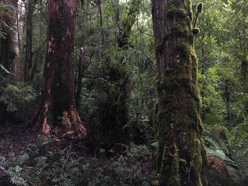
The Warburton Valley is surrounded by a mixture of wet and damp forest with cool temperate rainforest interspersed throughout the area.
Because these forests are damp and have high ecological values, we don't undertake fuel management in these areas.
These wet forests, like to the north of Warburton, are zoned as Planned Burn Exclusion Zones to indicate we cannot do planned burning here.
However, under extreme weather and drought conditions, these areas can still pose bushfire risk to the townships south of the forest.
We've placed Landscape Management Zones south of the Warburton Valley.
The primary goal of these zones is to maintain and promote ecosystem resilience by using fire to promote plant and animal diversity.
Burns within these zones are conducted under cool moderate conditions and aim to achieve a burn coverage of 10-50%.
Due to the fire history of the area, we burn infrequently in these Landscape Management Zones.
Healesville
Healesville has number of risk factors that we have considered in zoning around this area.
The majority of bushfire risk to Healesville comes from the north in the Hume region from public land. The area from Pheasant Creek to Yarra Junction is also historically known to have highly impactful bushfires.
Taking these factors into consideration, we have created areas of Bushfire Moderation Zones and Asset Protection Zones to the north of the Healesville area.
By conducting planned burning in these zones, we can reduce the risk of large-scale bushfires coming from the north in Hume region and impacting Healesville and surrounding areas.
We work closely with Hume region and inform their Fire Management Zoning to ensure townships in our region are considered in strategic planning.
We also work closely with the Healesville community in reducing bushfire risk in this area.
Bushfire Risk Engagement Areas (BREAs)
To protect the things we care about, agencies and communities need to consider ways of reducing bushfire risk across both public and private land.
On public land, our fuel management activities are undertaken across different Fire Management Zones.
To support bushfire risk reduction on private land, we've identified Bushfire Risk Engagement Areas.
Bushfire Risk Engagement Areas in the Metropolitan region cover both public and private land and help fire agencies to prioritise engagement with the community about managing fuels where it can be most effective. This includes considering a range of actions to reduce bushfire risk.
Where and how we engage with the community will also be informed by current conditions, such as fuel loads and rainfall.
Managing fuels on private and public land begins with a conversation about the benefits and limitations of fuel reduction to meet the needs of our local community and environment.
There is no new legal obligation for landowners within Bushfire Risk Engagement Areas to reduce bushfire fuels on their property.
By working together, land and agencies and communities will be able to better protect the things we value from being impacted by bushfire.
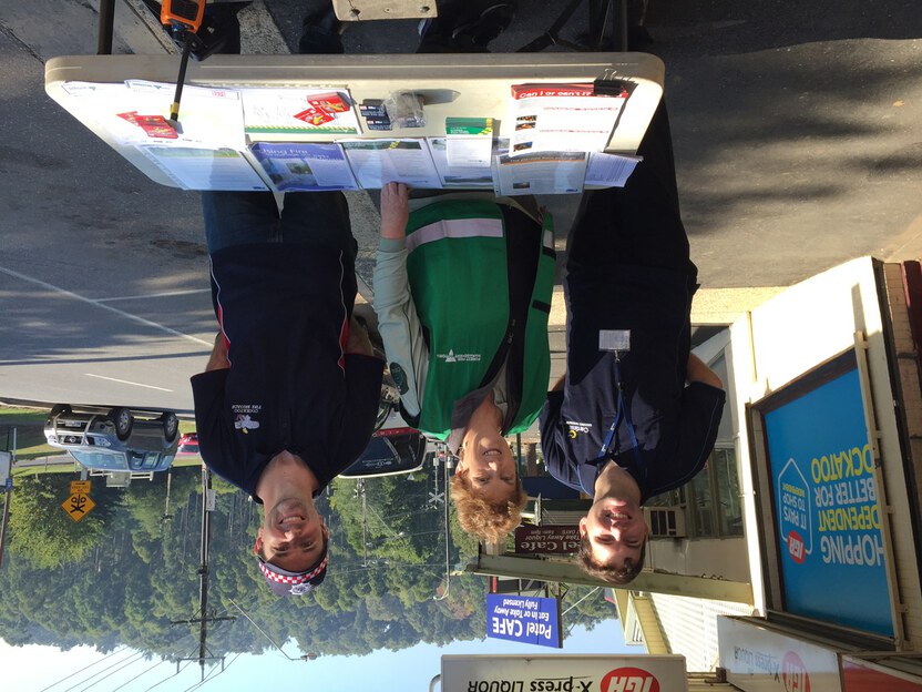
For more information or to get involved in fuel management activities on private land, contact your local CFA District.
Monbulk
Monbulk is a high bushfire risk community situated in the Dandenong Ranges. A passionate community group began work with FFMVic, CFA, Emergency Management Victoria (EMV) and local Council to develop a plan for treating their bushfire risk.
The Monbulk community decided to define fuel management priorities for private land in their community. They based their system on the public land Fire Management Zones (APZ, BMZ, LMZ and PBEZ) and considered local values, environment and views when placing zones. The zoning system provides guidance to local landowners to manage fuel loads on their land, to reduce the bushfire risk to themselves and the whole community.
One of the many outcomes of this work is that the community and fire agencies have a shared understanding and responsibility for managing bushfire risk and protecting the local community.
Cockatoo
In April 2018 FFMVic and CFA successfully completed a cross tenure fuel reduction burn in Cockatoo on public land at Wights Forest and on the adjacent council-owned Garden City Estate.
This burn had several objectives - to provide the highest level of bushfire protection to the residents of Cockatoo, their homes and the community’s assets; and to support research by the Arthur Rylah Institute (ARI) regarding the optimal fire severity, for germination of Hairpin Banksia seeds and the survival of seedlings across both public and council land.
Many months of planning and community engagement was undertaken prior to the burn by FFMVic, CFA, Cardinia Shire Council and ARI institute. This collaboration demonstrated the benefits of multiple agencies collaborating on fuel management across land tenures to reduce bushfire risk, and to inform future planned burning to support ecological objectives.
This concludes our Metropolitan region strategy. You can find out more information by downloading the full Bushfire Management Strategy.
Return to the state view to explore other regional strategies.